
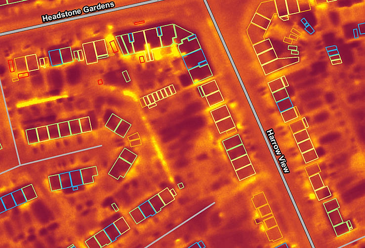
Thermal imaging and laser scan data collected by aircraft is helping Harrow Council tackle the growing problem of unscrupulous landlords renting out sheds and outbuildings as dwellings. Supplied by aerial mapping company Bluesky, the map accurate thermal images are combined with detailed LiDAR measurements to give staff at Harrow Council a much better understanding of where unpermitted developments may have been erected and their potential occupation evidenced as ‘hot spots’ in the data.
The Bluesky data is being combined with additional Council information such as waste collection, parking permits and noise complaints, for example as part of the government funded ‘Hot Harrow’ project.
The Bluesky data supplied to Harrow Council included property level map accurate thermal infrared images which can be used to highlight different levels of heat loss between individual properties and ‘unexpected hot spots’. When combined with additional data, within the Council’s Geographical Information System, these images can be used to identify and target individual properties for energy efficiency works or even support with fuel bills. ‘Hot spots’ in the data may also indicate illegal dwellings requiring further investigation and have already uncovered a number of cannabis factories.
Bluesky’s ability to simultaneously capture LiDAR (Light Imaging Detection and Ranging) was an important consideration to Harrow Council. LiDAR systems use aircraft mounted lasers to accurately determine the distance between the sensor and the ground or other targets such as buildings and vegetation which in turn provides the accurate height of buildings, vegetation and the ground.
Por bluesky-world
Sem comentários:
Enviar um comentário